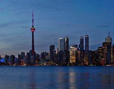

Most visitors arrive in Toronto looking for a skyline and leave without noticing the thing that actually shapes the city: it is cut to pieces by ravines. Roughly 300 kilometres of wooded valley run underneath the street grid, and the city protects about 110 square kilometres of ravine and natural land by bylaw. It is one of the largest urban ravine networks anywhere. Once you know they are there, a lot of Toronto stops being confusing — why neighbourhoods that look adjacent on a map take 25 minutes to walk between, why the city feels flat until it suddenly drops 40 metres, and why the best free afternoon here is spent below street level rather than above it.
Why Toronto looks the way it does
The short version is meltwater. The Oak Ridges Moraine sits about 30 kilometres north of downtown, a ridge of glacial debris. When the ice retreated, water ran off it toward glacial Lake Iroquois and carved down through nearly 100 metres of sand, gravel and clay till on the way. Those cuts are the ravines: the Don, the Humber, Taylor-Massey, dozens of smaller ones.
Lake Iroquois itself was much larger than today’s Lake Ontario, and its old northern shoreline runs along what is now Davenport Road. Stand at the bottom of the hill where Davenport meets Spadina and look up — that slope is a beach from roughly twelve thousand years ago. Everything south of it, including the entire financial district, is former lakebed. That is why downtown is table-flat and why the streets north of Davenport suddenly gain elevation.
The second thing worth knowing is administrative. In 1998 six municipalities — the old City of Toronto plus North York, Scarborough, Etobicoke, York and East York — were amalgamated into one city. Toronto is therefore not a single centre with suburbs around it; it is six former downtowns stitched together. That is why the core feels smaller than the population suggests, and why an address in Toronto can still mean a 45-minute subway ride from the CN Tower.
Getting in from Pearson
Toronto Pearson (YYZ) is about 22 kilometres northwest of downtown, and the fastest way in is the UP Express train from Terminal 1 to Union Station. It takes 25 minutes, runs every 15 minutes from 4:55 a.m. to 1 a.m., and costs CA$12.35 one way for an adult — or CA$9.25 if you tap a PRESTO card. Children under 12 travel free. There is no traffic to get stuck in, which matters more than the fare: the same trip by road at 5 p.m. on a weekday can take an hour or more.
If you are landing with luggage, small children, or at an hour when you simply do not want to work out a new transit system, a pre-booked private transfer with a fixed price is the calmer option. It is also the only version of this trip where the driver waits if your flight is late.
Billy Bishop Toronto City Airport is the other arrival point, out on the Toronto Islands. It connects to the mainland by a 90-second ferry — the shortest scheduled ferry crossing in the world — and by a pedestrian tunnel, and it leaves you a 15-minute walk from the financial district. If your route allows it, it is a far more pleasant way to arrive.
What to book before you land, and what it costs
Toronto has fewer genuine timed-entry bottlenecks than a European capital, but the CN Tower is one of them. Every CN Tower ticket is timed: you reserve a 15-minute elevator window and can then stay on the observation levels as long as you like. Tickets are released up to 30 days ahead. Prices are in Canadian dollars, before tax:
- Timed General Admission — CA$47 adult, CA$34 senior or youth, CA$18 child aged 3 to 5. This covers the Main Observation Level at 346 m and the Lower Observation Level at 342 m, where the glass floor and outdoor terrace are.
- The Top + General Admission — CA$59 adult. Adds the SkyPod, 33 storeys higher. You can also add it on the day for CA$12 once you are already up there, subject to availability.
- Flex — CA$62 adult. Same fixed date, no fixed time slot.
- Premier — CA$99 adult. Front-of-line at every stage plus 15% off in the shop.
- Sea the Sky — CA$79 adult, an online-only bundle of the CN Tower and Ripley’s Aquarium next door.
- EdgeWalk — from CA$199, a hands-free walk around the outside of the pod.
- Toronto CityPASS — CA$134.96 adult against a stated CA$217 value, covering five attractions over nine days.
The honest arithmetic: if the CN Tower is the only tower-type thing on your list, buy Timed General Admission and add The Top upstairs only if the sky is clear. If someone in your group wants the aquarium too, Sea the Sky saves real money. CityPASS only pays off if you genuinely intend to visit four or five of its attractions — which is a lot of indoor time for a short trip. If that is your plan, check the current Toronto CityPASS price before you buy the individual tickets, because the bundle is repriced periodically and the saving is not always the same.
What is free, and not worse for it
The Art Gallery of Ontario charges CA$30 for adult single-day admission, but it is free on the first Wednesday night of every month between 6 and 9 p.m. Book that free ticket online in advance, because they do run out. Admission is free year-round for Ontarians under 25 and for all Indigenous Peoples. If you expect to go twice, the CA$40 annual pass costs ten dollars more than one visit. The AGO is closed Mondays and open until 9 p.m. on Wednesdays and Fridays; the nearest subway station is St Patrick.
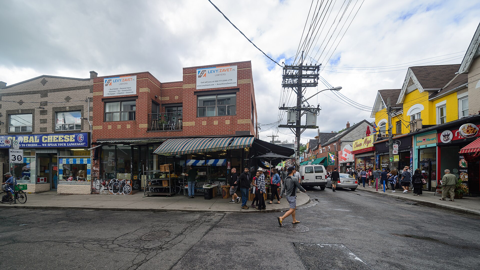
Beyond that: the ravine trails are free and are genuinely the best thing in the city. The Beltline Trail follows a failed 1890s commuter railway. The Don Valley trail runs from the Brick Works south almost to the lake. High Park is 161 hectares, free, and its cherry blossoms in late April or early May draw crowds that rival any paid attraction. Kensington Market costs nothing to walk through, and on Pedestrian Sundays in the warmer months the streets close to cars entirely. Graffiti Alley, a block south of Queen West, is roughly a kilometre of legal, constantly repainted murals.
Neighbourhoods, and what each one is actually for
- Downtown and the Entertainment District — the CN Tower, Ripley’s, Rogers Centre, Scotiabank Arena. Convenient, expensive, and largely empty of daily life after office hours.
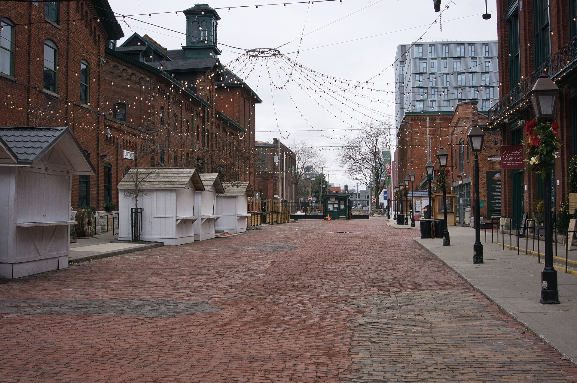
- Distillery District — a pedestrianised 19th-century whisky complex of red brick and cobblestone. Small enough to see in ninety minutes, and best in the evening or during the Christmas market.
- Kensington Market — the most concentrated food-and-secondhand block in the city, right next to Chinatown. Come hungry; do not come by car.
- Queen West and Trinity Bellwoods — independent shops, bars, and a park that works as the city’s summer living room.
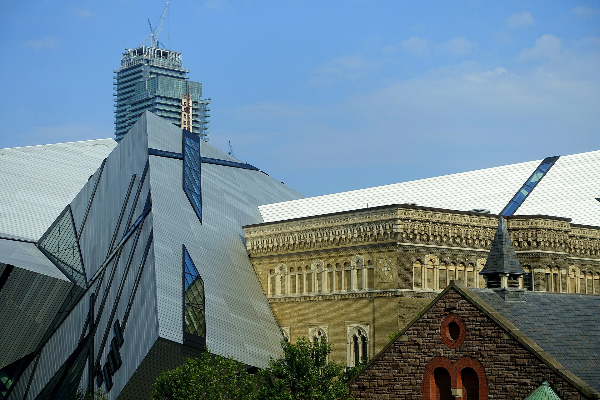
- The Annex and Yorkville — the university edge and the luxury retail strip, with the ROM sitting between them.
- Leslieville and Riverside — east of the Don, low-rise, brunch-heavy, and where a lot of locals actually eat.
- Scarborough Bluffs — 90-metre cliffs on the lakeshore, a long way east, and worth the trip on a clear day.
A three-day route that respects the geography
Day one — the lake edge. Start at the CN Tower on an early slot, before the summer haze builds. Walk east through the rail lands to St Lawrence Market, then carry on to the Distillery District for the late afternoon and finish on a patio in Corktown.
Day two — the islands and the west. Take the ferry from Jack Layton Ferry Terminal to Ward’s Island in the morning. The round-trip adult fare is CA$9.57, CA$6.15 for students and seniors, CA$4.51 under 14 and free under two, and the return leg needs no ticket at all. Walk the island chain west toward Hanlan’s Point, come back on the Centre Island boat, then head to Kensington Market and Chinatown for lunch and Queen West for the afternoon.
Day three — the ravines and the museums. Take the subway to Broadview or Davisville, drop into the Don Valley at Evergreen Brick Works, and walk. Come out at Bloor, do the ROM — advance online adult admission starts at around CA$26 — and end at the AGO if it is a Wednesday or Friday, when both stay open late.
If you have a fourth day, that is the Niagara day. It is roughly 130 kilometres each way and takes 90 minutes to two hours by road, longer on a summer weekend. Driving it yourself gives you Niagara-on-the-Lake and the wine route on the way back, which is the part most bus tours skip.
Eating, briefly and usefully
Toronto’s food case is not one cuisine done well but the sheer count of them done properly — more than half the city’s residents were born outside Canada. The practical version: Chinatown on Spadina, and the second and larger Chinatown out in Scarborough; South Asian food along the Gerrard East strip; Portuguese and Brazilian on Dundas West; Greek on the Danforth; Ethiopian on Bloor near Ossington; Caribbean roti in the west end. Peameal bacon on a bun at St Lawrence Market is the one local dish worth queuing for, and butter tarts are the regional pastry nobody warns you about.
Getting around once you are here
A single TTC fare is CA$3.30 with PRESTO, a debit card or a credit card, and it has now been frozen for a third straight year. From 1 September 2026 the TTC introduces automatic monthly fare capping: once you have paid 47 fares in a calendar month, the rest of that month is free, on any fare type, with nothing to buy in advance. That is also why the adult, youth, senior and Fair Pass monthly passes are being discontinued on 31 August 2026 — you no longer have to predict your own travel.
Two subway lines do most of the work: Line 1 runs in a U through downtown, Line 2 runs east–west along Bloor-Danforth. The streetcars are slower but reach the neighbourhoods the subway misses. Anything east of Victoria Park or north of Sheppard is bus territory and will eat an hour.
A car is a liability downtown — parking is expensive and the ravines mean there are fewer through-routes than the map suggests — but it becomes the right tool the moment you leave the city, for Niagara, Prince Edward County or Algonquin. If you are a group of five or more, renting one minivan usually beats two compact cars once you count parking and fuel.
When to go
Late May to late June, and all of September, are the two good windows: warm, long daylight, and the humidity that makes July and August unpleasant has either not arrived or has left. Toronto summers are genuinely humid, the lake does not help, and the city empties toward cottage country at weekends. Winter is cold and grey, but it is also when hotel rates fall by roughly a third and the ravines are at their quietest. Late April brings the High Park cherry blossoms and a crowd to match. TIFF takes over the first half of September and pushes accommodation prices up sharply for about ten days.
Practical notes
- Attraction prices are quoted before 13% HST, which is added at the till. Budget for it.
- Tipping is 15–20% in restaurants, and card terminals will suggest higher.
- Tap water is safe everywhere and free refills are normal.
- The PATH is a 30-kilometre underground pedestrian network downtown. In February it is not a novelty, it is the route.
- Distances mislead. Toronto covers about 630 square kilometres. Check the travel time before committing to a “quick” cross-city trip.